
Andover ZIP Code Directory Coverage
The standard Andover delivery ZIP is 01810. State and federal documents also label several special or unique codes as Andover, but those labels are not evidence that each code covers a local neighborhood. USPS determines a current delivery address. The Town Assessor and GIS describe parcels and municipal context. Keeping those systems separate prevents a ZIP code directory search from being mistaken for a resident list or a municipal-boundary map.
| ZIP | Areas Covered | Post Office | Notes |
|---|---|---|---|
| 01810 | Standard Andover residential and business delivery, including town streets and villages | Andover Post Office, 10 Stevens Street | Use USPS for a current address match |
| 01812 | Special or unique Andover-labeled use associated with an IRS address in official material | Current classification not independently located | Do not treat as broad neighborhood coverage; verify before use |
| 01899 | Special or unique Andover-labeled use in Massachusetts filing material | Current classification not independently located | Not a normal local-neighborhood ZIP in the research |
| 05501 | IRS service-center or unique mail address associated with Andover | Special address context | Not ordinary street delivery |
| 05544 | Historical IRS mail code in official prior material | Current assignment not located | Treat as historical or special until USPS confirms otherwise |
North Andover's 01845 can appear in nearby address searches, but it is not an Andover town ZIP and should not be added to an Andover ZIP code directory. A city label, a postal route, and a municipal border are separate systems.
Check an Andover ZIP Code Delivery Address
The USPS ZIP Lookup is the first current-delivery check. Its documented modes are By Address, By City and State, and cities-by-ZIP. Entering a complete street address gives the best postal answer. A returned ZIP validates the delivery addressing used by USPS. It does not identify a person, establish who owns a parcel, or settle a dispute about the Town boundary.
- Enter the full street address, city, and state in the USPS By Address mode when a precise delivery ZIP is needed.
- Use By City and State only to identify general postal results, then return to the complete address for an exact delivery check.
- For a special or unusual Andover-labeled code, confirm the current address directly with USPS before sending mail or making a record request.
- Use the Assessor or GIS only after the delivery ZIP is known and the question turns to parcel or town context.
The 01810 and special-code distinction is an important Andover ZIP code directory comparison: the former is the standard delivery starting point, while the others require more careful verification.
Note: A USPS result establishes a postal delivery match, not a connection between a named person and the address.
Andover ZIP Code Lookup Fields
USPS has the ZIP-specific search surface captured in the research. The local Assessor form has owner, street, parcel, value, sale, and property-characteristic fields, but no ZIP field. The GIS viewer is map and parcel based. The state voter form accepts a residential ZIP only with a named person's full date of birth. It does not produce a ZIP-wide voter result. This makes the postal form the correct tool for delivery verification.
| Field or mode | Type | Required | Format notes |
|---|---|---|---|
| By Address | Address lookup mode | Use a full address for the strongest result | Street, city, and state identify the delivery question |
| By City and State | Place lookup mode | City and state | Useful for general ZIP results, then refine with an address |
| Cities by ZIP | ZIP lookup mode | ZIP code | Returns postal-city context, not a municipal boundary ruling |
| Voter residential ZIP | Five-digit text field | Yes, with first name, last name, and full date of birth | Individual confirmation only, not a ZIP roster |
The Massachusetts voter search should never be used to assemble a ZIP-wide directory. M.G.L. c.51 §47C limits ordinary public availability of central voter names and addresses.
Andover ZIP Code Parcel Context
For property context, use the Town of Andover Property Lookup Tools, which link the Patriot Properties Assessor search and the GIS resources. The Assessor uses fields such as parcel, owner, street name, street number, building type, sale information, and book/page. It does not expose a ZIP filter in the inspected form. A property result can show the assessed owner, parcel identifier, situs, sale, and book/page, but it is not a current-occupancy finding.
MassGIS property-parcel data includes ZIP attributes, but it is statewide geographic data with parcel-boundary and update caveats. The MassGIS documentation is useful for understanding why a map attribute is not the same as a USPS delivery decision.
MassGIS property-parcel documentation is shown below as the ZIP-attribute fallback when local portal fields do not include ZIP.
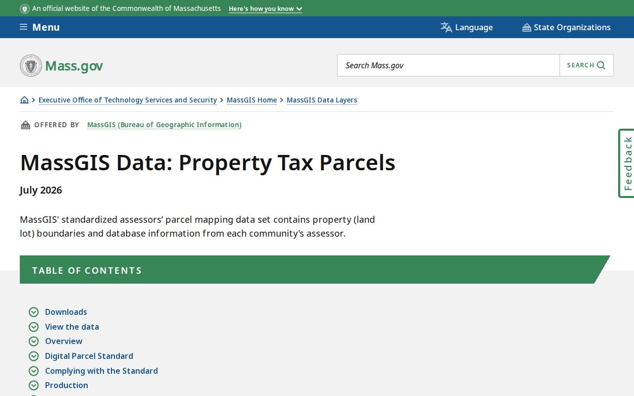
The document supports parcel-data context, while USPS remains the source for current mail delivery.
Andover ZIP Code Special Labels
Official Massachusetts and IRS materials are the reason several nonstandard codes appear in an Andover ZIP code directory. They do not establish broad town coverage. Massachusetts insurance material lists 01810 and 01812 for Andover. A Massachusetts filing lists 01810, 01812, 01899, 05501, and 05544 with Andover. IRS material connects 05501 to an Andover service-center address and identifies 05544 in older material. Current USPS classification and boundary data for several special codes was not independently located.
Use a special code only after checking the exact destination in USPS. Do not infer a nearby neighborhood from a state or federal document label. The research specifically distinguishes ordinary 01810 delivery from specialized, unique, uncertain, or historic code use. That check also prevents a specialized code from being copied into a parcel search or an old directory search where it has no historical meaning.
Andover ZIP Code and Town Lines
A ZIP code is designed for postal routing, while Andover's municipal line is a government boundary. The Town's GIS provides parcel, easement, zoning, wetland, district, and property-history context, but its parcel boundaries are informational rather than an exact legal survey. The Town has about 223 roadways, and old directory descriptions may use villages, districts, landmarks, or earlier street names instead of the delivery address now used by USPS.
The local address history adds another trap. Street names were adopted in 1905, Mineral Street became Red Spring Road, Green Street became Morton Street, and most houses were renumbered in 1959, particularly in West Andover. A historic city-directory address may need a map, plan, or nearby landmark before it can be compared with a ZIP-verified delivery address.
- ZIP versus ZIP+4
- A ZIP identifies a postal delivery area. ZIP+4 adds a more specific delivery segment; it is still not a town-boundary designation.
- PO-box ZIP
- A code associated with post-office box delivery rather than ordinary street delivery.
- Unique ZIP
- A specialized code assigned to a single institution or mail operation, not a neighborhood.
- Carrier route
- A postal delivery sequence used to move mail. It does not identify an owner or household.
Use an Andover ZIP Code Narrowly
A ZIP can narrow a question before another record is searched, but the local tools are not ZIP-wide person directories. USPS verifies the address. The voter form requires a name and date of birth in addition to the residential ZIP. The Assessor can search a street or parcel, then show a property record. GIS can display parcel context. None should be recast as a list of everyone attached to a ZIP.
Once a verified ZIP has narrowed an address to a street, the Andover street directory explains the separate address-based parcel, GIS, Registry, and historical workflow. That step uses exact parcels and legal descriptions rather than assuming every property in a postal code belongs to one municipal or historical area.
Andover ZIP Code Address Keys
Four address keys can describe the same place differently. A situs is the property location used by the Assessor and GIS. A mailing address is where tax correspondence goes and can be outside town. A legal description is the Registry's deed-and-plan language, often stronger than an old street number. A USPS delivery address is standardized for mail and ZIP assignment. Memorial Hall Library directories may instead use an old number, a corner, or a landmark.
| USPS delivery address | Use for a current ZIP verification question. |
|---|---|
| Assessor situs and parcel | Use for local property context and a link to sale or book/page fields. |
| Registry legal description | Use for a deed, plan, lot, or historical title search. |
| Historical directory address | Use for a dated household clue, with old-name and renumbering checks. |
Note: Do not substitute one address key for another without checking the record's date and custodian.
Verify an Andover ZIP Code Request
Before mailing a request or seeking a record, confirm the current destination with USPS, then identify the actual custodian. The Town Clerk holds local municipal records, the Assessor and GIS hold parcel context, Essex North Registry holds modern Andover land records, and Memorial Hall Library holds historical directories and street lists. A special ZIP label does not change the office that holds the record.
If a Town record is not available online, the Andover Public Records Center accepts targeted requests under M.G.L. c.66 §10. State the record type, address or parcel, date range, and preferred format. The office need not create a ZIP-sorted list that does not already exist.